Tuesday, March 4, 2014

2014 Umstead Marathon report

The first weekend in March is bittersweet.  The days are getting longer, the air is warming but not yet too hot...and it means I'll have to start cutting my grass again soon.  More happily, it also means the Umstead Marathon is upon us yet again.  This race is nothing short of the best marathon in the world - comprising the best park in Central North Carolina; a challenging but reasonable course; dedicated, detail-oriented organizers; enthusiastic, friendly volunteers and talented runners who don't act like they're talented.

This was to be my fifth marathon, and my fourth Umstead. I really have no business running in this event, but I felt some serious regret in 2012 when I skipped it.  So, no matter the poor shape of my legs and cardiovascular system (and conversely well-trained liver), I sat by my keyboard as registration opened in early November and was one of the first to sign up.

I have no race photos.  This would be a even more boring post with no pictures.  Here's a bouncy house.

Training was decent November through January, logging about 110 miles a month.  Work travel and fermented barley led to a 55 mile February, but come race day I felt OK despite not doing a long run over 16 miles.

We were granted nearly perfect weather on race day.  Right around freezing at the start, rising to the low 50s by early afternoon with some good cloud cover.  The usual pre-race festivities took place - people congregating by the fire in the lodge, the race director reading the names of several people who have participated in all 11 Umstead Marathons, and runners making several trips to the port-o-johns.
From here I'll divide my report into five equal pieces.

Miles 0-6, 1:03:14

About five miles of this is single track.  Last year I went out too "fast" (9:30 min/mile) and I paid for it later.  That was my first race on this new harder course, which had significantly more single track and I tried too hard to stick to a 10 minute pace.  This time, I laid back and didn't push it.  I even took a restroom break at about 5.5 miles - three pre-race portajohn visits apparently weren't enough.  I felt good, except for some groin issues that were new.

William B. Umstead does not approve of so many portajohn references

Miles 6-12, 2:02:47

After exiting single track for good at mile 8, most of the course is gentle downhill until mile 12.  I was still taking it pretty easy.  I got a bloody nose.  Only the second of my life unless you count the ones from people punching me.
Miles 12-18, 3:06:57

This section gives us the worst of Turkey Creek Trail.  The uphills hurt and slow you down.  The downhills tempt you to make up time, punishing your quads.  The only relief is the wonderful Paradise aid station.  I start "speedwalking" the steeper uphill sections around mile 16 or so as the pre-twinge of calf cramps set in.  I'm sure this is pure coincidence that this is also the longest training run I did.

Miles 18-24, 4:22:12

...and the wheels start to fall off.  This is easily the most difficult part of the course, and not just because it's near the end.  There are the well-documented horrors of the Corkscrew and Cedar Ridge, 2 miles of nasty steep uphill.  But even worse is The Sneaky Bastard.  This section starts right at mile 18 and is over a mile and a half of nearly constant, gentle incline.  It's uphill enough that it slows you down, but gentle enough that you don't really notice it and can't figure out why your pace is dropping.  Or at least, this is how I imagine it would be if I was ever in good enough shape to feel normal at this point.  The Sneaky Bastard also saps enough energy to make the two hills mentioned above even more miserable.  I ran-walked this section (or really, walked-ran-walked-r..walked) then was saved by the Reedy Creek aid station, where the wonderful volunteers plied me with Fritos and their own private stash of Endurolytes to help quench the thirst that wouldn't go away.  I was also fortunate to run into fellow runner Klay Barrow at the aid station, and we chatted for the mile or so run down to the base of the Corkscrew, allowing me to forget my many aches and pains - except when we were talking about our aches and pains.

The less said about the Corkscrew and Cedar Ridge the better.  It took me 14 minutes to go between markers 23 and 24, and I was shattered at this point.

Never mind what I'm doing with that hand in my pocket...(thanks freeracepics.com)

Miles 24-end, 4:49:45

I hobbled to the finish.  Not much to say here.  My inadequate training reared its ugly head here, as my legs were stiff and cramping.  Not a strong way to finish, but I got my pint glass and burrito, so all was good.  21 minutes better than last year, but off my personal best by 6 minutes (that was on an easier course).  I'm sure I had race winner Tim Crews sweating near the end, as he edged me out by a mere 108 minutes.

Recovery

The usual stiffness and soreness took over on Saturday and Sunday, but it nothing too bad.  Until 2am Sunday night, when I was awoken by a very intense pain (worst I've ever had) on my inner left knee.  One of the reasons I chose my wife was her training in sports medicine; she ran downstairs and got me some ice.  I fell asleep icing the knee, while she was unable to go back to sleep.  I'm such an ass.

I was able to go to the climbing gym Tuesday night with no issues, so I'm sure I'll forget the pain from this race and sign up next year.  After all, I only missed a coveted top-15 plaque by 68 minutes or so.  With another lackluster training period next year I'm sure to get one.

Tuesday, August 13, 2013

Running of the Bulls 8k - New PR strategy

This race report has been significantly delayed due to filing my intellectual property in a related area - namely, how to run a PR without fail.  Now that my IP's protected, I can reveal my approach to the masses:  run a distance you've never run before.  If you can't do that, just suck a little less with each passing year.

Nothing exciting about this report.  Met my cousin and his wife at the start line.  June 1 was a warm morning, so I started off easy.  I was targeting 40 minutes, and was surprised to see I ran a 7:40 pace for the first two miles with what felt like little effort.  Then, the sun and asphalt conspired against me and I finished in 40:52.  Meh.  But, there was beer and the end and food trucks, so it will be a repeat.

That's my 2nd PR of the year, to add to the Philosopher's Way 15k, I hope to add the Croatan 24 Hour run in November.  It would be nice to have four in 2013, so if either of you that read my blog hears of an 11k or 4.4 miler, let me know.

Saturday, June 1, 2013

House Mountain: 2 dudes, 4 ticks, a Big Butt, a rattlesnake and a dog

It had been nearly five months since I'd been in the mountains.  Far too long.  So with a free Saturday over Memorial Day weekend, I grabbed the dog and headed for the House Mountain Preserve near Lexington, VA to continue my quest to climb the 50 most prominent peaks in the southeastern U.S.

Left the house at 5:30 in the morning, and arrived at the House Mountain trail head at about 9am, where my peakbagging pal Rick Shortt was waiting for us.  There's a designated area for parking, as private property surrounds the preserve.  We headed up right away, following an old jeep road through the woods at a pretty steep clip until reaching the grassy saddle between Big and Little House (3645' and 3380', respectively).  A sign is there that gives a history of the area and honors Bill Stubbs for his tireless conservation efforts in Rockbridge County.

Gus at the House Mountain saddle, blissfully
unaware of the ticks crawling up his legs
Bill Stubbs memorial
From the saddle we headed right via an unmarked trail through tall grass.  It immediately transitioned to a STEEEP, rocky ass-kicker.    The unseasonably cool 70 degrees felt like 90 by the time we reached the summit ridge.  Rick's legs are often indistinguishable from the tree trunks surrounding the trail and he keeps a relenting, fast pace.


Nice rock arch on the trail up Little House Mountain
Gus struggled a bit with the boulders

We peakbaggers are an obsessive lot, and need to be certain we've hit the highest point to claim a summit.  For Little House mountain there are two elevation contours on the map that contend for the highest spot on the mountain, so both must be explored.  To reach the first it's a short detour through thick mountain laurel, but nearby cliffs offer nice views of the surroundings.  The second area is likely the summit, and it's a rare treat for our mountains down here - a 15 foot vertical scramble.  Rick found a nice crack system to climb - I was slower to follow with the crappy grip on my running shoes.   I'm a slow learner - this is at least the fourth time I've regretted wearing them on a hike.  You could call it class 3 or 4 - I've heard the rule that if a dog can do it, it's class 3...Gus refused to join us, whining at the base of the rock formation.  But he's also a wimp, so we'll call it 3+.  Getting down was trickier, requiring a firm handhold deep in the crack to support the downclimb.  Got our attention!

Rick climbing the Little House summit block
Me climbing the summit block.  The confused look on my visage is status quo.  Photo by Rick Shortt
The Little House trail continues for another quarter mile or so, which took us to a stunning vantage point.  Nice views of a Big Butt...Mountain.

Do these trees make my Butt look Big?  Yes, yes, they do.
After taking in the views from the vantage point, we headed to the main objective of the day, Big House Mountain.  Back down to the saddle we went, and hiked a more reasonable, well-trodden trail.  First stop was another nice vantage point with some nice outcrops.  We hung out there for a bit, hiked to the summit with its ugly old stone structure and then past it for about 3/4 of a mile to another great vantage point.

Rick taking in the views from Big House
Gus happy to have another summit under his belt
The return to the car was pretty uneventful.  Total mileage for this one was 9.8 miles with about 3400' of elevation gain.  Took us about 6 hours with all of the breaks.

At this point, Rick headed back home,  and Gus and I headed for one more peak - one of the seven bajillion Brushy Mountains in the Southeast.  This one has over 1000' of prominence and an elevation of nearly 3600', and since we were in the area...

Gus and I drove about 30 minutes to the trailhead in the Rich Hole Wilderness (the official geographer in these parts obviously had a great sense of humor).  Being in a wilderness, no trail markings are usually found.  The trail wasn't well marked either, and after about a mile it completely petered out.

This is a trail?
From there it was a steep climb through pretty easy vegetation to the summit ridge.  Gus was seriously doubting my navigational skills, but we made it to the ridge, weaving our way around some neat rock fins (stay to the right/north to avoid getting cliffed out).

Some of the rock fins along the Brushy Mountain summit ridge.
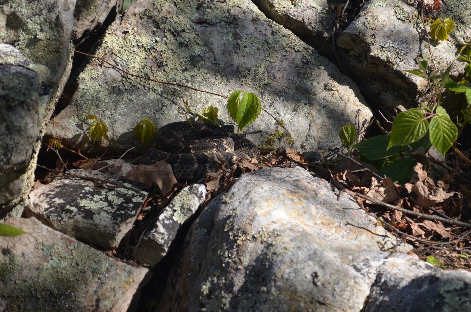
Finally reaching the summit area, I quickly took a few steps up some rocks to touch the tippy top of the highest point as is the usual silly peakbagging custom.  I heard something strange below me, instinctively moved back, and saw a rattlesnake coiled up on the ground next to me!  I'm still not sure if I heard a rattle, but I quickly retreated, held my dog's collar to keep him out of trouble, and snapped a couple of pictures.  Before I heard the snake my left foot couldn't have been more than a few inches from it and I didn't even see it!  I'm lucky it was cold for May..

The Brushy Mountain denizen.  Hard to see at first...
Another shot of the snake.  I was reaching for the high point in the picture when I spotted him.
Gus and I headed back down to the car, making it there uneventfully.  The Brushy Mtn hike was 3.2 miles with about 1150' elevation gain, giving us a respectable 13 mile, 4500' eg day.  This earned Gus a couple cheeseburgers (and me the pleasure of smelling dog flatulence) on the way home.

The spoils of a nice day in the mountains.  
Big and Little House Mountain
Directions, etc:

Big/Little House

From Lexington, VA, head west on US-60 for a couple of miles.  Turn left onto VA-641 (Jacktown Road) and proceed 3.4 miles.  Turn right onto VA-643 (Saddle Ridge Road) and follow the road until you reach signs for hiker parking at 37.81156° N, 79.53239° W.  The trail follows a road for the first bit (essentially a continuation of Saddle Ridge Road). Follow this, gaining elevation, until reaching the saddle between Big and Little House (37.82830° N, 79.55349° W).  For Little House, follow a trail going right (east).  It will soon fork; take the right fork and follow to the top.  This trail has blue blazes on it and is pretty steep.  You'll pass through a small boulder field on the way to the top.  Once you reach the summit ridge, follow the trail.  The first contour (37.82721° N, 79.54753° W) is off to the left in a thicket of mountain laurel.  Roam around until you find the high ground (you can continue in this direction to some cliffs for good views of Big House).  Return to the trail and continue.  You'll come to the summit block (I don't have exact coordinates as my GPS ran out of batteries, but the map gives it as 37.82926° N, 79.54360° W.  The face closest to the trail offers the easiest access to the top.   Climb up a ledge about 6' off the ground, then work your way up the crack.  Be sure to find the bomber hand-holder Rick found on the way up; you'll need it for support on the downclimb.  After getting up and down, one can head back to the saddle or continue along the trail to a nice viewpoint.  To get Big House from the saddle, take the more well-traveled path to the left and follow to the summit.  There's a short side trip to some great views near the last switchback below the top - continue straight instead of turning, and you'll soon be among some rock outcrops with nice views to the north and west.  The summit is along the trail and marked by an ugly stone structure.

Brushy Mountain (the one on the border of Rockbridge and Alleghany counties)

To reach Brushy Mountain from the House Mtn areas, get back on US-60 and head west until reaching I-64 in a few miles.  Go west 7 miles on I-64, taking exit 43 for VA-780 (Goshen).  Turn right onto 780 and after a quarter mile turn left onto VA-850/VA-780 (signed as W Midland Trail).  Continue to follow VA-850/W Midland Trail for 2.6 miles, where you'll reach a turnout in the road with a wood post marked "13."  This is the Rich Hole trailhead (37.86988° N, 79.62507° W).  Head up the trail, passing a registration kiosk.  When I was there, the trail was overgrown and hard to follow in places.  The map shows that the trail goes over the shoulder of Brushy Mountain, but I completely lost the trail at the first saddle (37.87313° N, 79.63429° W) and just bushwhacked straight up the ridge.  At the top of this bushwhack, turn left and follow the ridge to the summit (37.87147° N, 79.64134° W).  Round trip for this one is 3.2 miles with 1150' of elevation gain.

Thursday, March 7, 2013

Umstead 2013 - Report from the back of the pack

Work bosses:  "Shannon, we need you to go to Japan and Singapore for a couple of weeks."
Me: "Sure, no problem.  Can I plan it so I get back a couple days before the Umstead Marathon so I have an excuse for putting in a bed-shitting performance?"

This was my third Umstead, and I felt the best trained for this of any.  My previous PR was a very pedestrian 4:47, but I was hoping for a 4:20-ish finish this time.  I had been doing all of my long runs at Umstead without specific mileage in mind, just going as far as I could at a 10 minute pace.  During training I was up to 16-20 miles at this pace, and figured I'd just try to hang on during race dayblah blah blah blah....fffffffffftttttttttttttt.

The Wednesday before the race I found myself landing at RDU Wednesday night after a couple of weeks across the Pacific.  The timing was bad, but I decided to suck it up, sleep about 4 hours out of 48 on the double-Wednesday and try to cope that way.  On Thursday I was fine, to bed early and up early.  Only issues were sudden bouts of fatigue and some GI issues.  Hello foreshadowing.

Weather was perfect on Saturday.  Right around freezing before the start, with highs forecasted in the low 50s.  No precip.  The cabin was abuzz with activity pre-race.  It's cold outside, so almost everyone warms themselves by the fire.  This race also seems to have a cult following - the same faces are there year after year and so a lot of catching up takes place.  I don't blame them - this is hands down my favorite running event ever.


This is what pre-race looks like if you are a creepy-looking guy photographing strangers while standing on a table.

So anyway, the race starts, I feel OK, get to the single track and at mile marker 2 I have an overwhelming desire to lay down next to the trail and sleep.  Not a good sign, but this subsides after 20 minutes or so.  I run into bigger problems around mile 6.  Vomit.  Working its way up my esophagus.  I'm at a 9:30 pace at this point, so I'm not overexerting.  I walk up a steep section of single track.  Urge to vomit subsides.  Start to run again.  Vomit in esophagus redux.  Goddammit.

I lose the 10 minute/mile pace at 8 miles, and I'm down to 11 minutes/mile at mile 15.  I'm bitterly disappointed, and have to try hard to talk myself out of quitting at 15.  But it's hard to be pissed off at a race when the other runners are so friendly and the volunteers are so wonderful and enthusiastic.  It pisses me off even more that I can't be pissed off.

The rest of the race is running until nearing vomit status then walking.  I finished in 5:10:51 - my worst of the three Umstead for me.  But, I got a cool pint glass with a ring-necked duck and I have plenty of beer to fill it, so life ain't so bad.

Finisher of both the race and the bottle.  If you look carefully at the bottle, you'll see Lone Rider brewed something very similar to the Peacemaker for me to enjoy post-race.  Based on my time they offered to sponsor me next year.

If you're thinking of signing up for this race, don't.  It sucks.  Really badly.  Also, available slots for the race don't fill up quickly.  If you're not thinking of running this race, it really is the best event I've ever participated in, and it gets better every year.  I plan to run it until 2020, at which time I'll fail to make the 6 hour cutoff if my finishing time trend continues.

A hearty thank you to the race director, volunteers and fellow runners for making this such a great event.  And congrats to Brandon Carter (2:54:01holyshit) and Lorraine Young (3:03:59 courserecordholyshit) for their victories.


Tuesday, November 13, 2012

Croatan 24 Hour Report

The inaugural Croatan 24 Hour Ultramarathon is in the books.  It was a great race put on by Brandon Wilson, his family and volunteers. 

I'll give the short stat summary here:  I finished with 53.07 miles (22nd out of the 63 that started), reaching 50 miles by 13.75 hours then crashing.  More on that below.  But to back up...

The run took place in the Croatan National Forest, just a couple miles north of the southern tip of Emerald Isle.  74 runners signed up, but only 63 started.  Rumor has it the other 11 got confused and headed to the Croatian National Forest near Zagreb.  The object was to run a loop (slightly less than 1.37 miles) as many times as possible.  It was a pleasant loop - mainly nicely packed dirt with a few wood and aluminum footbridges that spanned the salt marsh.  It was flat except for a couple bridges that gained 10-15 feet of elevation near the middle of the loop.  I can honestly say that the views varied enough (looking out over the waters and running through the woods) that I never got bored with the route.  

At the start point, they had a table of volunteers that registered every lap, an area where we could drop bags of spare clothes, shoes, cyanide tablets and other things you may want in a run like this.  Finally, and most importantly, they had a tent with refreshments (water, Gatorade, coffee, chips, bananas, etc).  The refreshment tent also served lunch (veggie burgers), dinner (pizza) and had hot snacks to deal with the cold night (even veggie broth).  There were lots of veggie options and I didn't have to dip into the bag of stuff I brought.

Me, the naive fool smiling before the run.

Now on to the race report.  I tried hard not to set a mileage target, but I would have been disappointed at less than 50.  Greater forces prevailed, however, and on the ride from the condo we rented to the trailhead, my asshole left brain concocted an 80 mile run plan - 20 laps in the first 6 hours, 20 laps in the next 8 hours and a final 20 laps in the final 10 hours.  My right brain - distracted by glimpses of the sun shining through the pines - went along with the plan.

It being the 237th birthday of the Marine Corps, and with many veterans taking part in the race, there was a birthday party (with cake!) before the race.  I missed most of it as my wife and I put up my tent in case I wanted to get a couple of hours of sleep in during the night.  We were off and running at 8am.  Veterans led the first lap, with Cheryl Yanek (trying to qualify for the Women's National 24-hour team) running ahead to try to hit 120 miles.

5 laps (6.85 miles), 1:16

The first lap went well.  On the second lap, the left side of my groin started to hurt.  My groin and I were very close during my teenage years, but it seems now was the time that it would exact its revenge for years of neglect.  This was short-lived, however, and by the fourth lap I was feeling good again, trying to take it slow and not exceed an 11-ish pace.  So far all was going well.

10 laps (13.7 miles), 2:33

Still on track, but unfortunately my weak October was already starting to rear its ugly head.  I felt a bit of tightness starting to creep in to my quads on the 10th lap.  Also, it was getting warm, and I was wasting time at my drop bag, making sure I kept drinking enough HEED and taking an Endurolyte cap every hour to keep the electrolytes up.

15 laps (20.55 miles), 4:06

I ran the first 10 laps at an 11:10 pace, but the feeling of an unquenchable thirst was already setting in, a most unwelcome feeling that I get all the time during long runs in the summer.  I hate this feeling, and didn't expect it with temperatures not going much above 70F.  I walked lap 14, giving me a 13:35 pace for the last 5 laps.  I was enjoying myself a bit more, though, talking with various people.  It will surprise nobody who has run an ultramarathon that everyone I spoke to was extremely friendly and supportive - from the slowest to the fastest folks out there.

20 laps (27.4 miles), 5:59

I just did an ultra marathon, but holy hell.  For some reason, this felt worse than the Umstead marathons I've run before.  I was sweating more than expected, and felt nauseous.  This feeling stuck with me for a couple hours, but I figured it was par for the course and I just had to deal with it.  I ate a lot, drank a lot of water and Gatorade and took some Endurolytes.

25 laps (34.24 miles), 7:59

Still on pace for the left brain 80 mile plan, but just barely, and I pretty much felt like shit the whole time.  The last five laps were done at a 17:40 pace.  I walked almost all of this, and started to realize how quickly stops at the drop bag add up.  My groin flared up on lap 24 when I started to try to run, so I felt like walking for awhile was my best option.  I probably wasted an average of 2-3 minutes each lap, eating, drinking, looking for something, etc.  I changed from my Nike Frees to some older, more cushioned shoes to make it easier on my feet during the walk around lap 22.  This was a mistake - I got a blister from the old shoes within 3 laps and changed back after 25.  I still had both my sense of humor and nausea at this point.  Usually my humor makes others nauseous so this seems fitting.  A cool breeze started to blow here, which was really welcomed.  I also saw the men/women being separated from the girls/boys here.  A handful of runners were still going at a pretty good clip and looked like they had just started.

33 laps (45.2 miles), 11:44

I didn't record the 30 lap time, mainly because cognitive function was starting to take a hit.  A lot happened during these 8 laps.  First, I was overjoyed to see Tiffany (my wife) at the close of lap 26.  She told me I looked good, and that she was going to run an errand and meet me in an hour.  The bout of nausea was subsiding and I was cooling off.  I walked the next couple of laps pretty quickly as darkness fell.  At the end of lap 29 I put on a long sleeve shirt, ate some pizza and walked a couple laps with Tiffany.  My legs hurt - but it was just muscle soreness - no joint pain.  At the end of lap 31, the muscle soreness subsided a little and the nausea was complete gone...I felt better than I had in probably 6 or 7 hours.  Tiffany left to go get some dinner.  It was cooling off quickly, so I switched into long pants and put on a fleece.  I felt so good that I ran considerable portions of laps 32 and 33.  This, I believe, was my downfall.  The soreness came back quickly, forcing me to walk.  While walking, the slight breeze was enough to evaporate the sweat and cause some pretty nasty chills.

37 laps (50.68 miles), 13:45

34-36 were hell.  Legs hurt.  Could. Not. Get. Warm.  I had long pants, two shirts, a fleece and a wool hat on.  It was only 40 degrees, but I was shivering.  Normally in 40 degree weather I run in shorts and a long sleeve shirt.  I tried drinking coffee, vegetable broth and eating, but nothing seemed to help.  This caused the nausea to return.  I have to thank Ray Krolewicz, a guy who's run countless ultras, for walking a lap or two with me here to take my mind off of things.  A really positive, energetic guy who put up 70+ miles at the age of 57.  He once held the 48 hour world record - but he'd never tell you this - I found this out from other runners.  Tiff rejoined me for lap 37, and I decided to take a break.  I was really worried about my temperature, and decided to forgo the tent for a warm night at the condo.

My wife was awesome here.  She had gone out an gotten Epsom salts for me to soak in, and they really felt great!  I still couldn't get warm in the bath, however, and crawled into bed, hoping to wake up at 3am and get some more miles.

Basically, at 3am I was still freezing, and could barely move my legs - in fact, I didn't feel warm again until late Sunday night.  To make a long story short, I got out of bed at 6:15, and it took me 45 minutes (!) to get dressed. I drove back to the race, realized I didn't get any photos the previous day, and hobbled around the loop for 45 minutes taking a few photos to tack on a bit more distance, finishing with 53.08 miles.  I'll take it for my first marathon+ distance.


Some views from the loop


Just to call out a couple of amazing performances:

The men's winner was a 22 year old (ex?) Marine, JJ Jehangir who logged over 109 miles!  Jason LeDoyen (candidate for World's Nicest Person), who I had the fortune to speak with a few times and lives in the Triangle, finished with over 100 miles.  Cheryl Yanek didn't reach 120, but fought through a rough race to finish first female with over 104 miles.  Wow.  And perhaps most impressive was Walt Esser, a 74-year-old who did over 80 (!!!!!!) miles.  Goddam.

In my preview, I outlined a few goals.  How did I match up?


  •  Complete at least 50 miles, with a stretch goal to keep moving the entire time  Win!  and Fail!
  •  Avoid bleeding due to chafing or falling  Body Glide was awesome.  Absolutely no chafing or bleeding.  Other than a couple water blisters, my skin was unscathed.  I do feel sorry for Tiffany who happened to walk into the room while I was applying Bodyglide to the area between my buttocks.  She was certainly most negatively affected by the race.  I don't think she's eaten since Saturday
  •  Hallucinate at least four times  Didn't happen.  Got too much sleep.
  •  Maintain fluency in English, mainly to complain about my self-inflicted situation  Check!
  •  Avoid sleeping  Epic fail.
  •  Remain married after my long-suffering wife supports me all night...despite smelling like a locker room, farting with reckless abandon and asking for favors with a whiny whiny voice  Tiffany was AWESOME!!!  Gave up her weekend to take care of me, and did a great job.  Very supportive, and even let me lounge around the house on Sunday evening nursing my legs.
  •  Count how many times I claim "I'll never do this again," then see how long until I sign up for another one of these.  Didn't happen.  At no point was I not having fun, even if I did feel like shit.  I'd love to do this race again next year.  I also realized that I will not be a regular ultramarathon runner for the next few years.  For me to be even half-way decent I'd have to take too much time away from family, work and other things I'm interested in.  I'd like to do one or so a year, though.


  • Thursday, November 8, 2012

    Croatan 24 Hour Preview

    I run my first ultramarathon Saturday morning - the Croatan 24.  At least, I hope it will be an ultramarathon.  Training in July-September was great - 120-130 miles a month.  In October I dropped to 56 miles to conserve energy and gained 5 pounds to ensure a tight fit of my running shorts.  Everything's going according to plan.

    Looking forward to it.  Training can really compete with family, work and other hobbies, so I'm not sure when I'll get a chance to do another one.  My goals are:

    •  Complete at least 50 miles, with a stretch goal to keep moving the entire time
    •  Avoid bleeding due to chafing or falling
    •  Hallucinate at least four times
    •  Maintain fluency in English, mainly to complain about my self-inflicted situation
    •  Avoid sleeping
    •  Remain married after my long-suffering wife supports me all night...despite smelling like a locker room, farting with reckless abandon and asking for favors with a whiny whiny voice
    •  Count how many times I claim "I'll never do this again," then see how long until I sign up for another one of these
    Wish me luck.

    Saturday, September 1, 2012

    First Night Run

    To prepare for my upcoming 24 hour run in November, I figured it was time for a night run to see how my body dealt with fatigue and running in little light. 

    After work on Friday a couple of weeks ago, I went home, made dinner and packed some water and snacks.  At 10pm I left for a well-known park in the Raleigh area.  I planned to go for four hours, but cut it short after 13 miles due to a turned ankle.  There were pros and cons to doing the long run at night.

    Pros:

    This was a great twist on a long run and broke the recent monotony of long runs.

    It cut into prime beer drinking time, so I felt great Saturday morning

    I had the whole park to myself

    Cons:

    It's hard to tell debris from horse poop at night without a headlamp

    Horsepoop on your shoes makes them slippery

    It's hard to see ruts in the bridle paths due to recent heavy rains

    When you step in these ruts you can twist your ankle pretty badly

    Running on smelly twisted ankles sucks.

    Thursday, August 23, 2012

    The Beer Mile

    There's three posts I haven't got around to writing yet, but I got a really distracting e-mail from my college friend Luth today that pushed them all to the side.  The Beer Mile.  You simply run four quarter mile laps around a track.  Oh, and you have to drink a 12 oz can of beer (at least 5% alcohol by volume, thank you very much) before each lap.  Add a penalty lap (with no extra beer) for vomiting.

    The world record is 5:09.  All I have to do is be able to chug the four beers in negative 82 seconds and the record is mine!

    Recently, Olympian Nick Symmonds gave the record a shot.  Here's the link to the story.

    Might be fun just to see what my time would be...

    Hmm...

    Wednesday, August 15, 2012

    Unaka Mountain with the Boys

    Over the last weekend of July, my son, dog and I decided to give my wife some peace and quiet for the weekend, so we headed out to the Tennessee/North Carolina border.  I had also been doing long runs in the 15-20 mile range over the last few weekends, so this was also a chance to give the legs an easy weekend.  

    We piled in the car at 8am Saturday, drove west and by noon were turning off TN-395 to the Gravel Beauty Gap Road.  Of course we had to stop and snap a few photos at Beauty Gap before parking the car at a small pull-out and starting the hike.


    Beauty Spot Gap on the NC/TN border

    The hike up was pretty non-eventful, following the Appalachian Trail through the woods and up a few rocky ledges


    Gus taking a break after an apparently exhausting initial quarter mile

    Brogan and Gus after a brief steep rock section of the AT


    until entering a quiet, gorgeous pine forest at the very top.  We stopped and had a snack


    Near the summit of Unaka, admiring the tall pines


    Another summit!

    while Brogan enjoyed the novelty of having his left foot in North Carolina and his right foot in Tennessee.


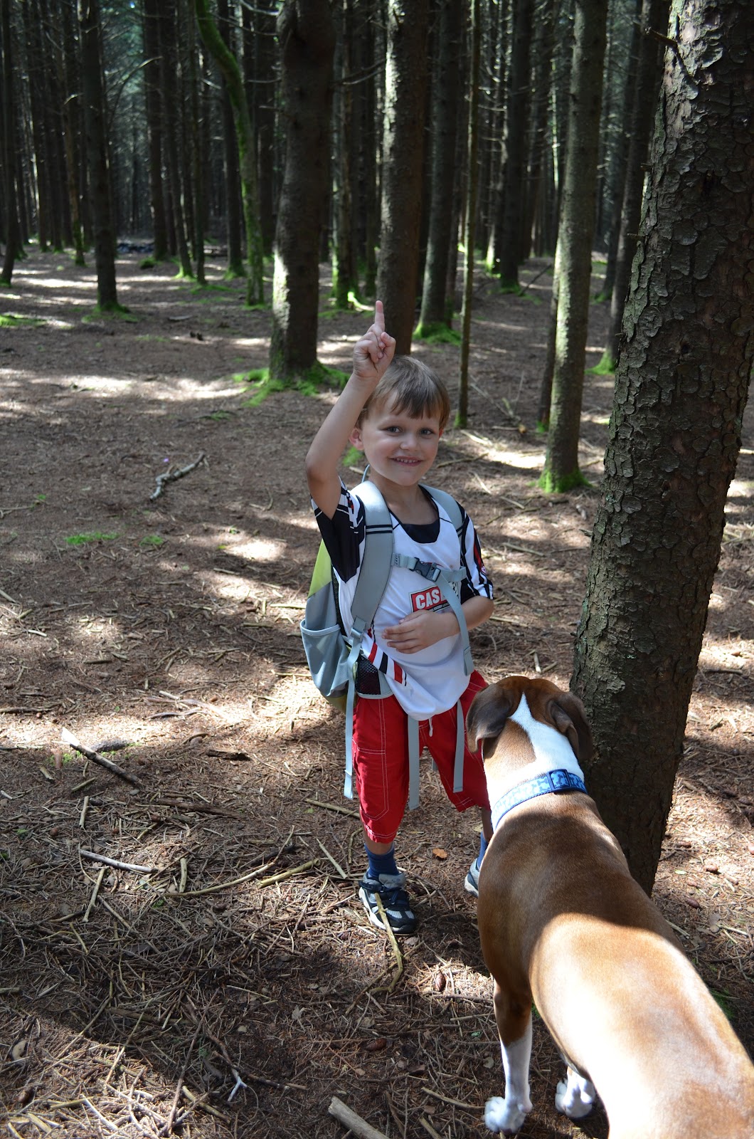
    Straddling North Carolina and Tennessee.  He's just as dorky as I am

    We headed back down to the car, with an easy day under our belts - 3.1 miles round trip with just over 1000' of elevation gain.  We stopped for another small peak on the way to the Rock Creek Campground just off TN-395 where we spent the night.  We lucked out and ended up next to a great family that invited us over.  I chatted mostly with the grandfather, a local who grew up in Unicoi while Brogan played with two brothers that were 8 months older and younger than him.  They had so much fun they were up until 11pm before I finally got him to bed.

    Waking Brogan up the next morning was tough after his late bedtime - I don't think he got out of the tent until 10am.    


    Two reluctant risers
    Gus went nutso as he tends to do, exhausting himself while the boys played with him.


    A thoroughly exhausted dog - it's hard work running around with a leash in your mouth
    At noon (and after some tears about leaving his new found friends), we moved to the trailhead for a hike to the Rock Creek waterfall.  This is a nice trail, wide and well maintained.


    The Rock Creek Falls trail.  Note that Brogan is wearing the same clothes as the day before.  This is what happens when Mom isn't around...
    The trail follows Rock Creek for most of its distance, and spices things up a bit with four easy stream crossings.  Well, easy if you have long legs.  Little ones need to take a little more care.


    Negotiating a stream crossing
    Proudly showing the stream he just crossed "without falling in once."
    After about an hour and a half we reached the falls, which were pretty impressive - about 60' high.  I, being a dumbass, brought only my telephoto lens.  This made it impossible to get a good shot with the three of us in front of it with the self-timer, so you'll have to settle for Brogan in the frame to set the scale.


    Brogan in front of the falls.
    Brogan fell trying to reach the big ledge, which was not his favorite experience - the water was cold even in July.


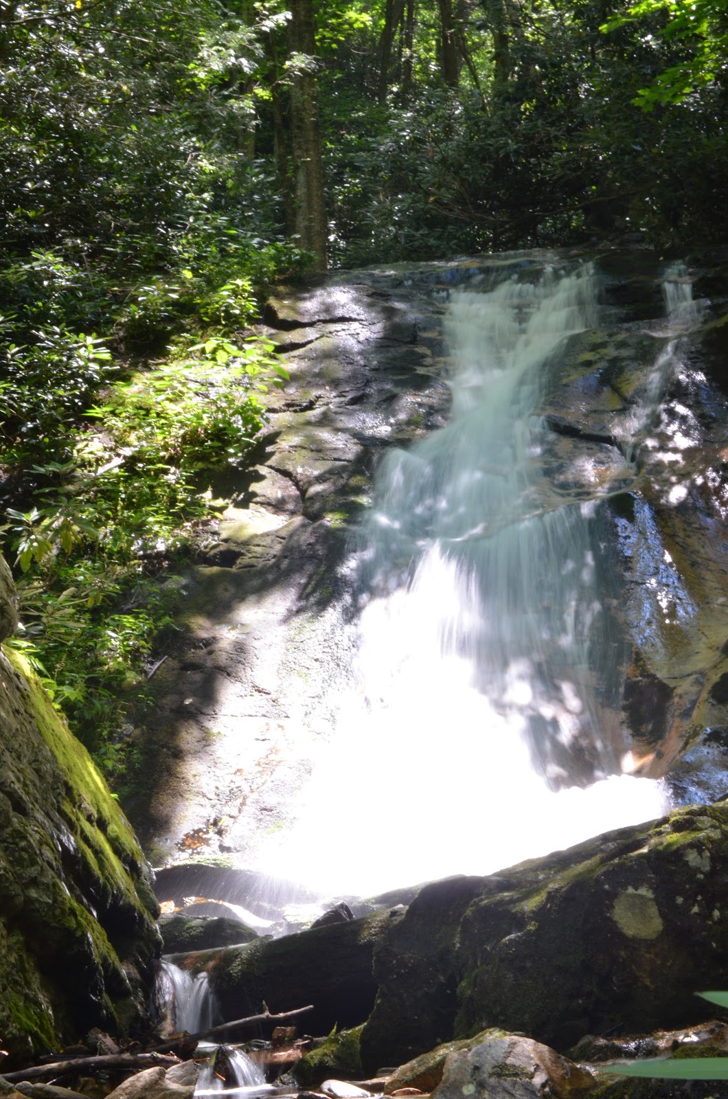
    Rock Creek Falls
    The walk back down was uneventful, wrapping up a 4.4 mile, 1000' elevation gain day.  We found mountain laurel blossoms Brogan wanted to bring some home for his mom, and we did a good job keeping them alive until we arrived home that evening. 


    Always thinking of his mom


    Brogan was very enthusiastic about the waterfalls, so we'll have to work more of those in in the future.


    Thursday, July 12, 2012

    Trip to the Alps

    Note – this is a long, pretty dry report of a trip to bag peaks in Europe.  I always find these kind of reports helpful when planning hikes and climbs, so I’m trying to do my part to repay the community (wow, that sounds very arrogant).  No offense if you just want to scroll through the pictures.  I poached quite a few from Rob Woodall, who got better shots than I did in a number of places.

    A few months ago I was informed I’d be in Germany for a weeklong meeting in June.  Once it became clear we weren’t going to be turning it into a family vacation, my thoughts turned to peakbagging.  I got in touch with Rob Woodall, a fell runner from England who has climbed on five continents, and Lee Newton, a Scot who has lived in Switzerland for the last five years.  The plan would be that I’d meet them in Switzerland with our primary objective being a two-day climb of Tödi (11,857’, P5151’), a peak in northeast Switzerland.  This was the primary target as it was one of the ultra-prominence peaks that neither Lee nor Rob had done.  We’d go for other objectives as time permitted.

    Day 1 (June 15, 2012)

    Day 1 travel - Kleinheubach to Aschaffenburg to Schwägalp

    After the conclusion of my meeting on Thursday night, I woke up early and took a taxi to the town of Aschaffenburg, where I picked up my rental car.  After a few stall-outs I was reacquainted with manual transmission, and was soon heading south on the Autobahn.  The Germans may have gotten some things horribly wrong (Falco, lederhosen...and perhaps some other things I’m forgetting), but they certainly got the Autobahn right.  No slow driving in the left hand lane, no speed limits, well-maintained roads.  It was a blast – I even got my Toyota Auris over 120 mph!

    After five hours of driving, I made it through Germany and into Switzerland, up a windy road to the charming hamlet of Schwägalp, which is little more than a cable car station and hotel.  This is the staging ground for summiting Säntis (8,209’, P6628’), another ultra-prominence peak.  The surroundings are what I’ve always associated with the alps: snow-capped, sharp grey peaks thrusting up through lush, impossibly green valleys.


    Säntis from near the cable car station
    I had planned on doing a snow climb of the peak, but it was 3pm at this point and I was worried the sun had softened the snow too much to make a good attempt by foot, so I took the easy way up – a $46(!) cable car ride to the top.  The views were spectacular despite the extensive development at the summit. 


    There was a small geology museum, displays of equipment used in historic Himalayan expeditions, a gift shop and at least one restaurant.  After an hour or so at the summit, I rode the car back down and had a couple local beers at the hotel.  I then pulled into a far corner of the parking lot and went to sleep as soon as it got dark at 11pm.


    One letter away from a very amusing sign - also describes the outcome if I had succumbed to temptation and abandoned my vegetarian diet on this trip.


    Day 2 (June 16)

    Day 2 travel
    The sun woke me up at 5:15, and I headed back down the winding road to the Swiss highway.  My destination was the Heidilands rest area, which doesn’t sound very appealing.  This, however, is not your typical American rest area.  I knew there was a food court there, but was expecting greasy fast food.  Much to my surprise, there was fresh bread, salad, roasted vegetables and freshly made sandwiches all of high quality.  A glorious place, but this being Switzerland – very expensive.  I got there at 7:30 in the morning, and tried to call my night owl wife on the pay phone.  Unfortunately this appeared to be a rare night when she was asleep by 1:30 in the morning.  I killed four hours waiting for Lee and Rob by getting my glacier travel gear in order and reading a couple books I had on hand.

    Upon arrival, the three of us sat down over lunch to make plans.  Unfortunately, the area had seen an unseasonable amount of late season snow the previous week, and the current high temperatures were causing rapid melting.  This meant significant avalanche danger on the routes up Tödi, so we reluctantly abandoned plans to climb it.  After some discussion we decided to do an afternoon climb of the Schwarzhorn (10,322’, P1999’) and make further plans that evening.

    We had about a two hour drive to the Flüela Pass in eastern Switzerland, where the lushness turned to a barren blackness (hence the name Schwarzhorn).  The peak looked a little forbidding upon first glance

    Schwarzhorn, our objective (from the Fluelapasse)


    The trail began on bare ground, but was soon covered in snow, and we got our ice axes ready.


    Lee near the start of the climb


    Trail signs well buried in snow.  Evidence of recent snow avalanches are visible above Rob's shoulder (L).  Our path went up and to the right.
    
    As we approached the snow climb, we saw evidence of multiple recent avalanches, confirming our decision to abandon plans for Tödi.

    Most of the route was pretty straightforward, although we did have to hurry in places as the sun was warming the snow, releasing rockfall.  We were particularly speedy through this traverse:

    
    Lee and I traversing under a rock face.  We moved quickly here as there was evidence of rockfall, but it wasn't too bad at all.  Photo by Rob Woodall.
    
    After an easy climb up the snow bowl, we gained the summit ridge.  From here it was a mix of scrambling and easy snow climbing to the top.  The only annoyance was the soupy snow that the sun had melted, making for slow going.

    Looking up the summit ridge at Rob and Lee.


    View down the summit ridge.  Photo by Rob Woodall.


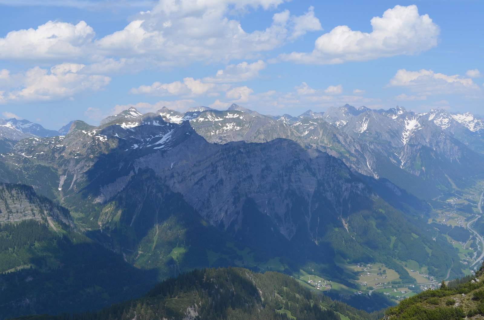
    At the summit we were treated to fantastic views of the eastern Swiss alps.  The recent snows were still plainly visible.  With little wind and great weather we lingered on the summit and had a snack as Rob and Lee tried to identify all the big peaks.


    Summit views
    The descent was uneventful, except for a minor fall I had on a traverse – my rusty self-arrest skills were still good enough to stop the little slide.  We plunge-stepped our way back down quickly, making it back to the trailhead in about a quarter of the time it took us to ascend.  Total stats for this were pretty tame: 4.4 miles roundtrip with 2640’ of elevation gain.  The snow slowed us down quite a bit – we took 4 hours and 25 minutes to go up and down.

    Afterwards we checked into the bunkhouse at the Flüela Pass just near the trailhead, and had dinner at the small café.  My resolve as a vegetarian was put to the test – some delicious meat dinners were on the menu, while I had one option – spätzle with cheese with the typical central European meat substitute – the fried egg.  I had no problems downing it along with a beer.  Over dinner, we discussed plans for the next day and decided on a morning hike of Kuhgrat (6,965’, P2234’), the only mountain with 2000’ of prominence in Liechtenstein followed by a hike up to the Douglasshütte in Austria to put us in position for a snow climb of Schesaplana (9,728’, P2710’) the following day.  This being Switzerland, my simple dinner in a simple café was $25, thank you very much.

    Our lodging for the night
    We washed up in the bathroom of the bunkhouse and went to sleep about 10:30 in anticipation of a pretty full day.

    Day 3 (June 17)


    “It’s 6:15, gentlemen.”  We all had overslept our alarms, and Lee had luckily kept that to a minimum.  We were up quickly, I shoved some bread and cheese in my mouth, and began the one hour drive to the trailhead.  We parked near some houses then took a faint trail (a euphemism for being lost) that went within 8 or 10 feet of many houses as we passed them.

    Nice view from near the start of our hike
    After a few minutes we hit the main trail.  Cows stubbornly blocked the way.  Yep, this is the Alps

    Enough cowbell
    After a short bit of walking we started to get some views of the surroundings.  The trail is essentially cut into the side of the mountain, affording great views of the valley below.  The Rhine, one of Europe’s major rivers, looks pretty humble near its source, and it’s hard to believe it helped cut through the mountain ranges here. 

    The "mighty" Rhine

    Part of the trail.  Note the bridge to the far right of the picture
    The trail is pretty exposed – in some areas a careless fall would have been...um...interesting, and with pebbly rocks littering the ground, it was necessary to pay attention and use the hand cables when available.  I was a bit surprised, and happy, to see a family with their 8-year-old making their way up this trail.  Good to see evidence of at least one family that doesn't shield their child from all potential danger at any cost.

    With care, the walk was uneventful, except in a 20’ snow-covered tract of the trail that was consistently getting hit by minor rockfall – not enough to damage from the impact but enough to knock you off your feet and send you on a long fall.  We took turns quickly crossing this area, and were soon near the summit ridge.  At this point, the hot sun was baking us, and we welcomed the intermittent clouds coming up from the valley below that delivered cool, moist air.

    The Kuhgrat summit is barely visible through the cloud in the upper right.  You can also see the trail leading up.
    We reached the summit, 3.3 miles after leaving the trailhead.  Views were spectacular in all directions.

    The trail continued along this ridge

    Kuhgrat ridge with our trail.

    Views from the summit ridge with Lee in the foreground

    I listened to Lee converse with the locals, stuffed some more food in my face, then we headed back down.

    I'm technically a sückafool but I went right anyway
    Care was again required on the descent, especially near the melting snow that was releasing even more rock.

    An exposed section of the trail, made trivial by the hand cables.  Photo by Rob Woodall
    Views were also nice on the way down (duh)


    Views on the way down.  Photos by Rob Woodall.
    We were back at the car after a 6.6 mile hike with just under 3000’ of elevation gain.  It took us 4 hours and 40 minutes, quite a bit slower than expected. 

    As we prepared to drive to our next objective, I “pulled a Shannon.”  I took my ice axe out of the car for some reason and forgot to put it back before driving off.  Oops.  A nice $70 mistake.  I hope the Liechtensteinians enjoy it.

    We stopped for lunch and confirmed plans for Schesaplana.  After a long, winding drive up a very narrow paved road we reached the parking area.  A cable car ascended to our destination, the Douglashütte, but we just missed the last car up at 5pm.  Instead, we had an steep 1 mile hike up to the top.

    Our path up to the Douglasshütte, crossing a couple small snowfields.  Photo by Rob Woodall 
    The Douglasshütte is situated on the Lunersee, an absolutely spectacular lake at about 6500’.  A great set-up, with a shower and nice beds.  I got a shower, had a couple beers in the dining hall (where the hut warden told us that most of his customers are people who take the cable car up, get drunk at the outdoor café and head back down the cable car), and the three of us went to bed.  It being early in the season, we had a 12 bunk room to ourselves.

    Stunning views from the hut.  Photo by Rob Woodall
    Day 4 (June 18)

    Day 4 travel
    We woke up at 5am, just around sunrise.  We wanted to get up and down before the snow got too soft, but didn’t want to mess with headlamps. 

    The well kept bunk room at the Douglasshutte

    We were out the door by 5:45 or so.  The first mile or so was on dry trail, and we took our time taking in the magnificent scenery as the sun rose and lit up the snow-covered peaks.

    Lee and Rob on the trail as the sun rises

    Alpenglow
    It didn’t get cold enough overnight to freeze the snow, so we climbed without crampons to the higher hut (the Totalphütte), which we reached after two and a half hours.

    The Totalphutte at about 7260'
    The hut was staffed; some folks had stayed there to have a faster summit day.  Here we took a short rest, took in the views, and put on our crampons for the steeper terrain ahead.  At this point, we also noticed a lenticular cloud, a harbinger of bad weather, forming in the distance.  The weather wasn’t supposed to turn bad until the evening, but we kept an eye on things anyway.

    Lenticular cloud looming over our route
    We left the hut on a nice gentle traverse of an easy snow slope before we turned towards the summit and things got steeper. 

    The sun felt this hot when the wind died down.

    Rob ascending the first snow bowl

    Lee and I taking a break after a steep bit.  Photo by Rob Woodall
    After steep climbs up a couple of snow bowls, we pushed our way through the snow-corniced summit ridge, where we were greeting with a cold, biting wind.

    View down the summit ridge after coming through the cornice

    View up the summit ridge.  I think Rob got me taking the picture above this one.
    I instantly put on another layer of clothing, and tried to hide behind a short rock wall at the summit.  Not much helped, so after 10 minutes taking pictures and exploring the summit, we headed back down.

    The early descent was slightly nerve-wracking.  In the mere 45 minutes since we ascended through the corniced ridge, the sun had softened the snow considerably.  Lee took the lead on the descent, having trouble getting good footholds.  The snow would fall out from under his feet as he tried to kick steps. 

    Lee trying to get enough purchase to begin the downclimb.  Photo by Rob Woodall

    Lee kicking steps in the very soft snow - not fun.  Photo by Rob Woodall
    The slope was probably a 45 degree angle here, and the snow was probably too soft for a self-arrest, meaning a nice long fall if he left his feet.  Eventually he found some firmer snow, and I followed down, kicking firmer steps…although I also experience snow slabs falling from under my feet.  I had to rely on my borrowed ice axe on a couple of occasions before finding solid footholds.  This difficulty only lasted for about 20 vertical feet and we were back on firmer snow.  We had a pretty uneventful descent, making good time plunge-stepping down soft snow.  We did have some concern for those coming up later – it was already 11am and the snow was only going to get softer.

    We reached the hut (total climb stats: 8.5 miles with about 4600’ of elevation gain), and after a quick coffee, we took the cable car down – Lee needed to get back home to Basel, and Rob and I were planning on another summit before I dropped him at the Zürich airport that evening and we wanted to save time.  The cable car was only about 6 euro (Austria is much cheaper than Switzerland), we got to the parking lot, transferred Rob’s gear to my car, and parted ways with Lee. 

    Rob and I had an hour drive to the Itonskopf (6,854’, P2001’) trailhead located in Bartholomäberg, Austria.  We parked near a “gästhaus,” (probably legally) at 2:00 with roughly 5 hours to make it up and down with time to spare to make Rob’s flight.  It was hot – about 85ºF – and I was glad to exchange my 4 pound mountaineering boots for my running shoes.

    We set a pretty aggressive pace on the ascent – about 3.5 miles per hour while gaining elevation quickly.  I was soon very hot, pouring sweat in running shorts and a short-sleeve shirt.  Rob had on long sleeves and pants, and looked like he was out for a Sunday stroll.  I knew he was very fit, but not how fit – three weeks later he would run a 48 mile, 17,000’ elevation gain circuit in England in well under 12 hours!(!)  

    Anyhow, we ascended through some nice pastoral scenery, looking very fondly upon any shade we came across.


    Views during the ascent of Itonskopf.  Photos by Rob Woodall
    We had our first sight of the summit after about 90 minutes – it looked quite daunting.  We didn’t have much information on this peak, and I was hoping not to have to scramble up the ridge in front of us.


    Initial glimpse (top), followed by a closer look at the summit.  Good to see the trail snaking around to an easier ascent.  Photos by Rob Woodall
    As we got closer, we encountered some annoying patches of snow and slippery grass, but eventually made it to the summit.  Rob reckoned the trail went around the mountain for an easier ascent.  As I was catching up he bounded forward like a gazelle to check out the route ahead – and he was right.  A path ascended the peak, although the pebbly ground made hand cables necessary on parts of the ascent.

    The views from the summit were spectacular, and there was a nice breeze to cool us off.   We took our time up here.


    Some great summit views
    Some initial care was required on the descent,

    Descending in my stylish outfit.  Photo by Rob Woodall
    and once on solid ground we jogged a good portion of the way back to the car, cooling off our heads in a spring-fed watering trough for the livestock in the area.  Stats:  7.7 miles, 3,215’ elevation gain, 3 hours and 26 minutes.

    After a one hour drive to drop Rob at the Zürich airport, I stopped at a gas station to fuel up, spend my last Swiss francs on much needed food, and began the drive north back to Frankfurt.  I planned to stop at a hotel along the way, but waited too long.  The only place I could find off the road was €110, and I didn’t want to spend that for about five hours’ sleep.  I finally ended up driving the whole five hours back to the Frankfurt area, where I pulled into a rest area and slept – completely exhausted after a full 21 hour day.

    Day 5 (June 19)

    Final day travel


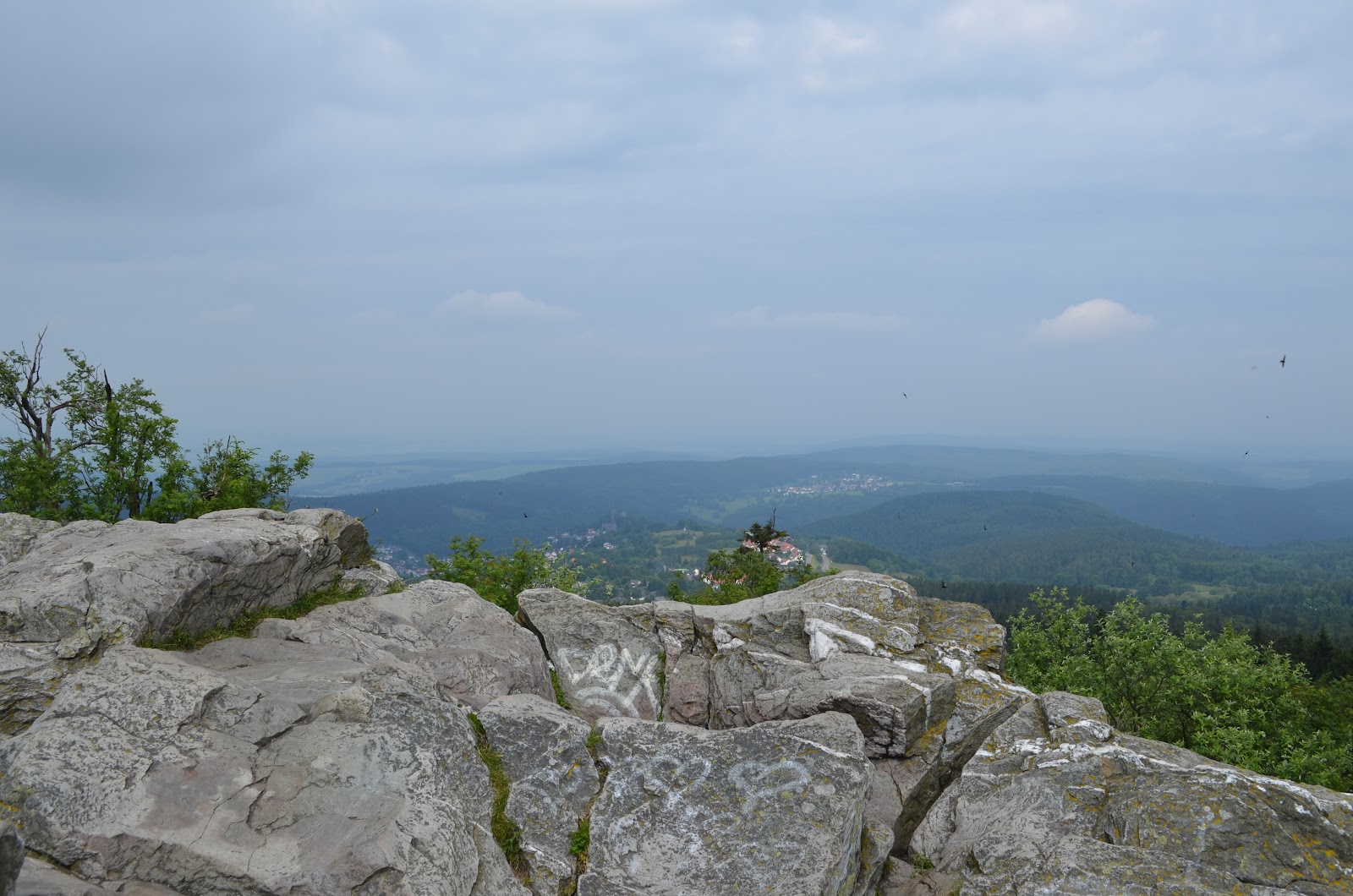
    At 6am, the sun woke me up again.  I took a much-needed shower (only €2!) at the rest area, and drove towards Großer Feldberg (2,884’, P2185), a hill north of Frankfurt, before flying home.  The scenery was a lot different than what I encountered the last four days, but with time to kill I walked around, had a coffee and bought a souvenir for my five-year old son.  It was a horn, which was sure to be a hit because it a) made noise and b) could be used to tease our dog.


    Views from summit and surrounding areas
    I drove an hour to the airport, excited to get back home to my family after such a successful trip. 

    Thanks to Lee for all of the planning and to both Rob and Lee for making plans to join me on a central European peakbagging trip.

    Most of all, thanks to my wife, for holding down the fort for the 11 days I was gone and for putting up with my silly hobby.  I realize I’m lucky to have a spouse that encourages me to pursue an activity that brings me so much joy.