Note – this is a long, pretty dry report of a trip to bag peaks in Europe. I always find these kind of reports helpful when planning hikes and climbs, so I’m trying to do my part to repay the community (wow, that sounds very arrogant). No offense if you just want to scroll through the pictures. I poached quite a few from Rob Woodall, who got better shots than I did in a number of places.
A few months ago I was informed I’d be in Germany for a weeklong meeting in June. Once it became clear we weren’t going to be turning it into a family vacation, my thoughts turned to peakbagging. I got in touch with Rob Woodall, a fell runner from England who has climbed on five continents, and Lee Newton, a Scot who has lived in Switzerland for the last five years. The plan would be that I’d meet them in Switzerland with our primary objective being a two-day climb of Tödi (11,857’, P5151’), a peak in northeast Switzerland. This was the primary target as it was one of the ultra-prominence peaks that neither Lee nor Rob had done. We’d go for other objectives as time permitted.
Day 1 (June 15, 2012)
![]() |
| Day 1 travel - Kleinheubach to Aschaffenburg to Schwägalp |
After the conclusion of my meeting on Thursday night, I woke up early and took a taxi to the town of Aschaffenburg, where I picked up my rental car. After a few stall-outs I was reacquainted with manual transmission, and was soon heading south on the Autobahn. The Germans may have gotten some things horribly wrong (Falco, lederhosen...and perhaps some other things I’m forgetting), but they certainly got the Autobahn right. No slow driving in the left hand lane, no speed limits, well-maintained roads. It was a blast – I even got my Toyota Auris over 120 mph!
After five hours of driving, I made it through Germany and into Switzerland, up a windy road to the charming hamlet of Schwägalp, which is little more than a cable car station and hotel. This is the staging ground for summiting Säntis (8,209’, P6628’), another ultra-prominence peak. The surroundings are what I’ve always associated with the alps: snow-capped, sharp grey peaks thrusting up through lush, impossibly green valleys.
![]() |
| Säntis from near the cable car station |
I had planned on doing a snow climb of the peak, but it was 3pm at this point and I was worried the sun had softened the snow too much to make a good attempt by foot, so I took the easy way up – a $46(!) cable car ride to the top. The views were spectacular despite the extensive development at the summit.
There was a small geology museum, displays of equipment used in historic Himalayan expeditions, a gift shop and at least one restaurant. After an hour or so at the summit, I rode the car back down and had a couple local beers at the hotel. I then pulled into a far corner of the parking lot and went to sleep as soon as it got dark at 11pm.
![]() |
| One letter away from a very amusing sign - also describes the outcome if I had succumbed to temptation and abandoned my vegetarian diet on this trip. |
Day 2 (June 16)
![]() |
| Day 2 travel |
The sun woke me up at 5:15, and I headed back down the winding road to the Swiss highway. My destination was the Heidilands rest area, which doesn’t sound very appealing. This, however, is not your typical American rest area. I knew there was a food court there, but was expecting greasy fast food. Much to my surprise, there was fresh bread, salad, roasted vegetables and freshly made sandwiches all of high quality. A glorious place, but this being Switzerland – very expensive. I got there at 7:30 in the morning, and tried to call my night owl wife on the pay phone. Unfortunately this appeared to be a rare night when she was asleep by 1:30 in the morning. I killed four hours waiting for Lee and Rob by getting my glacier travel gear in order and reading a couple books I had on hand.
Upon arrival, the three of us sat down over lunch to make plans. Unfortunately, the area had seen an unseasonable amount of late season snow the previous week, and the current high temperatures were causing rapid melting. This meant significant avalanche danger on the routes up Tödi, so we reluctantly abandoned plans to climb it. After some discussion we decided to do an afternoon climb of the Schwarzhorn (10,322’, P1999’) and make further plans that evening.
We had about a two hour drive to the Flüela Pass in eastern Switzerland, where the lushness turned to a barren blackness (hence the name Schwarzhorn). The peak looked a little forbidding upon first glance
![]() |
| Schwarzhorn, our objective (from the Fluelapasse) |
The trail began on bare ground, but was soon covered in snow, and we got our ice axes ready.
![]() |
| Lee near the start of the climb |
![]() |
| Trail signs well buried in snow. Evidence of recent snow avalanches are visible above Rob's shoulder (L). Our path went up and to the right. |
As we approached the snow climb, we saw evidence of multiple recent avalanches, confirming our decision to abandon plans for Tödi.
Most of the route was pretty straightforward, although we did have to hurry in places as the sun was warming the snow, releasing rockfall. We were particularly speedy through this traverse:
![]() |
| Lee and I traversing under a rock face. We moved quickly here as there was evidence of rockfall, but it wasn't too bad at all. Photo by Rob Woodall. |
After an easy climb up the snow bowl, we gained the summit ridge. From here it was a mix of scrambling and easy snow climbing to the top. The only annoyance was the soupy snow that the sun had melted, making for slow going.
![]() |
| Looking up the summit ridge at Rob and Lee. |
![]() |
| View down the summit ridge. Photo by Rob Woodall. |
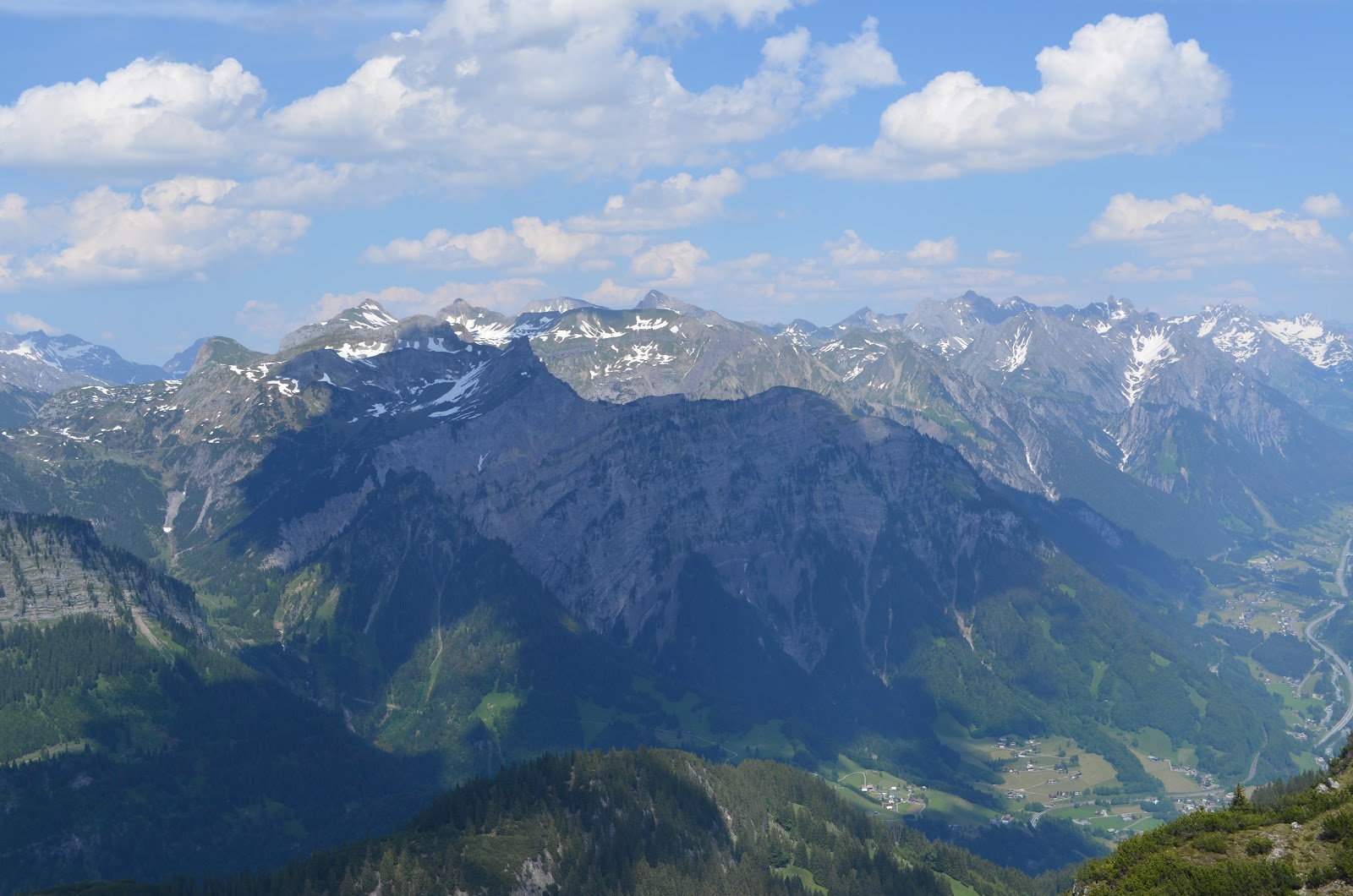
At the summit we were treated to fantastic views of the eastern Swiss alps. The recent snows were still plainly visible. With little wind and great weather we lingered on the summit and had a snack as Rob and Lee tried to identify all the big peaks.
![]() |
| Summit views |
The descent was uneventful, except for a minor fall I had on a traverse – my rusty self-arrest skills were still good enough to stop the little slide. We plunge-stepped our way back down quickly, making it back to the trailhead in about a quarter of the time it took us to ascend. Total stats for this were pretty tame: 4.4 miles roundtrip with 2640’ of elevation gain. The snow slowed us down quite a bit – we took 4 hours and 25 minutes to go up and down.
Afterwards we checked into the bunkhouse at the Flüela Pass just near the trailhead, and had dinner at the small café. My resolve as a vegetarian was put to the test – some delicious meat dinners were on the menu, while I had one option – spätzle with cheese with the typical central European meat substitute – the fried egg. I had no problems downing it along with a beer. Over dinner, we discussed plans for the next day and decided on a morning hike of Kuhgrat (6,965’, P2234’), the only mountain with 2000’ of prominence in Liechtenstein followed by a hike up to the Douglasshütte in Austria to put us in position for a snow climb of Schesaplana (9,728’, P2710’) the following day. This being Switzerland, my simple dinner in a simple café was $25, thank you very much.
![]() |
| Our lodging for the night |
We washed up in the bathroom of the bunkhouse and went to sleep about 10:30 in anticipation of a pretty full day.
Day 3 (June 17)
“It’s 6:15, gentlemen.” We all had overslept our alarms, and Lee had luckily kept that to a minimum. We were up quickly, I shoved some bread and cheese in my mouth, and began the one hour drive to the trailhead. We parked near some houses then took a faint trail (a euphemism for being lost) that went within 8 or 10 feet of many houses as we passed them.
![]() |
| Nice view from near the start of our hike |
After a few minutes we hit the main trail. Cows stubbornly blocked the way. Yep, this is the Alps
![]() |
| Enough cowbell |
After a short bit of walking we started to get some views of the surroundings. The trail is essentially cut into the side of the mountain, affording great views of the valley below. The Rhine, one of Europe’s major rivers, looks pretty humble near its source, and it’s hard to believe it helped cut through the mountain ranges here.
![]() |
| The "mighty" Rhine |
![]() |
| Part of the trail. Note the bridge to the far right of the picture |
The trail is pretty exposed – in some areas a careless fall would have been...um...interesting, and with pebbly rocks littering the ground, it was necessary to pay attention and use the hand cables when available. I was a bit surprised, and happy, to see a family with their 8-year-old making their way up this trail. Good to see evidence of at least one family that doesn't shield their child from all potential danger at any cost.
With care, the walk was uneventful, except in a 20’ snow-covered tract of the trail that was consistently getting hit by minor rockfall – not enough to damage from the impact but enough to knock you off your feet and send you on a long fall. We took turns quickly crossing this area, and were soon near the summit ridge. At this point, the hot sun was baking us, and we welcomed the intermittent clouds coming up from the valley below that delivered cool, moist air.
![]() |
| The Kuhgrat summit is barely visible through the cloud in the upper right. You can also see the trail leading up. |
We reached the summit, 3.3 miles after leaving the trailhead. Views were spectacular in all directions.
![]() |
| The trail continued along this ridge |
![]() |
| Kuhgrat ridge with our trail. |
![]() |
| Views from the summit ridge with Lee in the foreground |
I listened to Lee converse with the locals, stuffed some more food in my face, then we headed back down.
![]() |
| I'm technically a sückafool but I went right anyway |
Care was again required on the descent, especially near the melting snow that was releasing even more rock.
![]() |
| An exposed section of the trail, made trivial by the hand cables. Photo by Rob Woodall |
Views were also nice on the way down (duh)
![]() |
| Views on the way down. Photos by Rob Woodall. |
We were back at the car after a 6.6 mile hike with just under 3000’ of elevation gain. It took us 4 hours and 40 minutes, quite a bit slower than expected.
As we prepared to drive to our next objective, I “pulled a Shannon.” I took my ice axe out of the car for some reason and forgot to put it back before driving off. Oops. A nice $70 mistake. I hope the Liechtensteinians enjoy it.
We stopped for lunch and confirmed plans for Schesaplana. After a long, winding drive up a very narrow paved road we reached the parking area. A cable car ascended to our destination, the Douglashütte, but we just missed the last car up at 5pm. Instead, we had an steep 1 mile hike up to the top.
![]() |
| Our path up to the Douglasshütte, crossing a couple small snowfields. Photo by Rob Woodall |
The Douglasshütte is situated on the Lunersee, an absolutely spectacular lake at about 6500’. A great set-up, with a shower and nice beds. I got a shower, had a couple beers in the dining hall (where the hut warden told us that most of his customers are people who take the cable car up, get drunk at the outdoor café and head back down the cable car), and the three of us went to bed. It being early in the season, we had a 12 bunk room to ourselves.
![]() |
| Stunning views from the hut. Photo by Rob Woodall |
Day 4 (June 18)
![]() |
| Day 4 travel |
We woke up at 5am, just around sunrise. We wanted to get up and down before the snow got too soft, but didn’t want to mess with headlamps.
![]() |
| The well kept bunk room at the Douglasshutte |
We were out the door by 5:45 or so. The first mile or so was on dry trail, and we took our time taking in the magnificent scenery as the sun rose and lit up the snow-covered peaks.
![]() |
| Lee and Rob on the trail as the sun rises |
![]() |
| Alpenglow |
It didn’t get cold enough overnight to freeze the snow, so we climbed without crampons to the higher hut (the Totalphütte), which we reached after two and a half hours.
![]() |
| The Totalphutte at about 7260' |
The hut was staffed; some folks had stayed there to have a faster summit day. Here we took a short rest, took in the views, and put on our crampons for the steeper terrain ahead. At this point, we also noticed a lenticular cloud, a harbinger of bad weather, forming in the distance. The weather wasn’t supposed to turn bad until the evening, but we kept an eye on things anyway.
![]() |
| Lenticular cloud looming over our route |
We left the hut on a nice gentle traverse of an easy snow slope before we turned towards the summit and things got steeper.
![]() |
| The sun felt this hot when the wind died down. |
![]() |
| Rob ascending the first snow bowl |
![]() |
| Lee and I taking a break after a steep bit. Photo by Rob Woodall |
After steep climbs up a couple of snow bowls, we pushed our way through the snow-corniced summit ridge, where we were greeting with a cold, biting wind.
![]() |
| View down the summit ridge after coming through the cornice |
![]() |
| View up the summit ridge. I think Rob got me taking the picture above this one. |
I instantly put on another layer of clothing, and tried to hide behind a short rock wall at the summit. Not much helped, so after 10 minutes taking pictures and exploring the summit, we headed back down.
The early descent was slightly nerve-wracking. In the mere 45 minutes since we ascended through the corniced ridge, the sun had softened the snow considerably. Lee took the lead on the descent, having trouble getting good footholds. The snow would fall out from under his feet as he tried to kick steps.
![]() |
| Lee trying to get enough purchase to begin the downclimb. Photo by Rob Woodall |
![]() |
| Lee kicking steps in the very soft snow - not fun. Photo by Rob Woodall |
The slope was probably a 45 degree angle here, and the snow was probably too soft for a self-arrest, meaning a nice long fall if he left his feet. Eventually he found some firmer snow, and I followed down, kicking firmer steps…although I also experience snow slabs falling from under my feet. I had to rely on my borrowed ice axe on a couple of occasions before finding solid footholds. This difficulty only lasted for about 20 vertical feet and we were back on firmer snow. We had a pretty uneventful descent, making good time plunge-stepping down soft snow. We did have some concern for those coming up later – it was already 11am and the snow was only going to get softer.
We reached the hut (total climb stats: 8.5 miles with about 4600’ of elevation gain), and after a quick coffee, we took the cable car down – Lee needed to get back home to Basel, and Rob and I were planning on another summit before I dropped him at the Zürich airport that evening and we wanted to save time. The cable car was only about 6 euro (Austria is much cheaper than Switzerland), we got to the parking lot, transferred Rob’s gear to my car, and parted ways with Lee.
Rob and I had an hour drive to the Itonskopf (6,854’, P2001’) trailhead located in Bartholomäberg, Austria. We parked near a “gästhaus,” (probably legally) at 2:00 with roughly 5 hours to make it up and down with time to spare to make Rob’s flight. It was hot – about 85ºF – and I was glad to exchange my 4 pound mountaineering boots for my running shoes.
We set a pretty aggressive pace on the ascent – about 3.5 miles per hour while gaining elevation quickly. I was soon very hot, pouring sweat in running shorts and a short-sleeve shirt. Rob had on long sleeves and pants, and looked like he was out for a Sunday stroll. I knew he was very fit, but not how fit – three weeks later he would run a 48 mile, 17,000’ elevation gain circuit in England in well under 12 hours!(!)
Anyhow, we ascended through some nice pastoral scenery, looking very fondly upon any shade we came across.
![]() |
| Views during the ascent of Itonskopf. Photos by Rob Woodall |
We had our first sight of the summit after about 90 minutes – it looked quite daunting. We didn’t have much information on this peak, and I was hoping not to have to scramble up the ridge in front of us.
![]() |
| Initial glimpse (top), followed by a closer look at the summit. Good to see the trail snaking around to an easier ascent. Photos by Rob Woodall |
As we got closer, we encountered some annoying patches of snow and slippery grass, but eventually made it to the summit. Rob reckoned the trail went around the mountain for an easier ascent. As I was catching up he bounded forward like a gazelle to check out the route ahead – and he was right. A path ascended the peak, although the pebbly ground made hand cables necessary on parts of the ascent.
The views from the summit were spectacular, and there was a nice breeze to cool us off. We took our time up here.
![]() |
| Some great summit views |
Some initial care was required on the descent,
![]() |
| Descending in my stylish outfit. Photo by Rob Woodall |
and once on solid ground we jogged a good portion of the way back to the car, cooling off our heads in a spring-fed watering trough for the livestock in the area. Stats: 7.7 miles, 3,215’ elevation gain, 3 hours and 26 minutes.
After a one hour drive to drop Rob at the Zürich airport, I stopped at a gas station to fuel up, spend my last Swiss francs on much needed food, and began the drive north back to Frankfurt. I planned to stop at a hotel along the way, but waited too long. The only place I could find off the road was €110, and I didn’t want to spend that for about five hours’ sleep. I finally ended up driving the whole five hours back to the Frankfurt area, where I pulled into a rest area and slept – completely exhausted after a full 21 hour day.
Day 5 (June 19)
![]() |
| Final day travel |
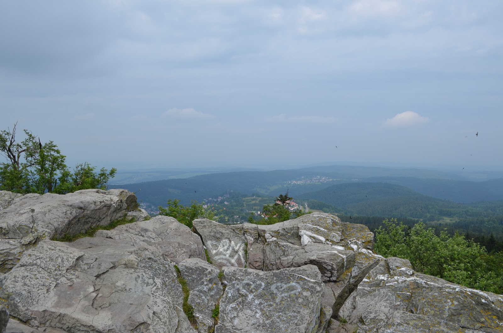
At 6am, the sun woke me up again. I took a much-needed shower (only €2!) at the rest area, and drove towards Großer Feldberg (2,884’, P2185), a hill north of Frankfurt, before flying home. The scenery was a lot different than what I encountered the last four days, but with time to kill I walked around, had a coffee and bought a souvenir for my five-year old son. It was a horn, which was sure to be a hit because it a) made noise and b) could be used to tease our dog.
![]() |
| Views from summit and surrounding areas |
I drove an hour to the airport, excited to get back home to my family after such a successful trip.
Thanks to Lee for all of the planning and to both Rob and Lee for making plans to join me on a central European peakbagging trip.
Most of all, thanks to my wife, for holding down the fort for the 11 days I was gone and for putting up with my silly hobby. I realize I’m lucky to have a spouse that encourages me to pursue an activity that brings me so much joy.